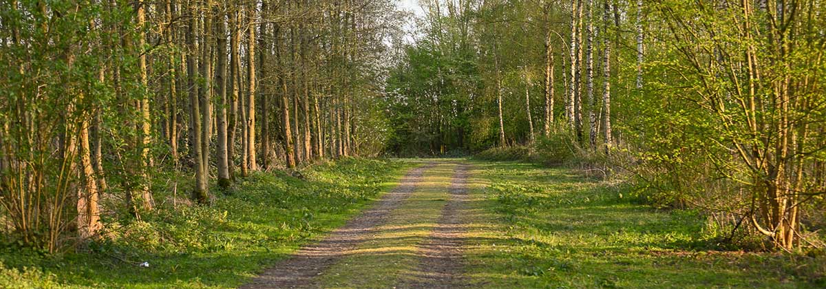
The Orveyt forest
It is a 30-hectare forest and nature reserve built on an old clay hill in the area of Zwevegem. You will find a unique combination of orchids and grasses. Especially in spring and early summer the area is a feast for the eyes.
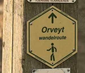
Follow the octagonal sign for the Orveyt hiking path.
The Orveyt hiking trail starts in the Stationsstraat in Moen (part of the community of Zwevegem), at the former Moen-Heestert station. Via the old railway, now a surprising nature reserve, you reach the Bossuit-Kortrijk canal. Abandoned and disused railways are the perfect places to discover a wealth of wildlife.
The Souterrain
This is where there used to be an underground tunnel for shipping, called ‘de souterrain’. (literally means “the underground”)
More info on Wikipedia

The “Souterrain” was a tunnel of the canal from Bossuit to Kortrijk. The design of the canal showed that the Moense hills on the route were an almost insurmountable obstacle. With the means available at that time, it was almost impossible to excavate the entire canal at that place, therefore it was decided to dig a tunnel. The construction became superfluous after the widening of the canal in 1974 and was demolished some time later for safety reasons.
On the other side of the canal you will discover the “Orveytbos”, created by the widening works on the canal, and the lovely and protected “Sint-Pietersbrugje”.
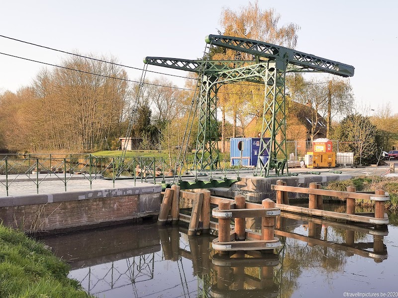
The St. Peter’s Bridge is relatively rare: not many 19th century examples of iron lift bridges remain.
It was operated by hand: the bridge keeper turns a wheel to lift it up, but due to the counterweights and the gearing he doesn’t have to exert much force.
The bridge has served more than a hundred years: when the canal was widened in the 1980s, the bridge was placed on this old canal arm.
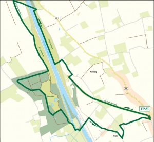
The orveyt walking route
This is a 7 km hike, It’s advisable to wear good shoes and make the hike in a dry period, as the path along the old railway line can be quite muddy.
Click on the image below to download the pdf from the website of Westtoer


Additionnal walk to the Mortagne Forest
The Mortagnebos (small forest and playground for children) and Orveytbos are only a stone’s throw from each other. Together they account for 46 hectares of young nature with woods, hay and grasslands. It is not only an ideal place for fauna and flora, but also a great place for childeren to play. In the play area of the Mortagnebos, children are in charge!
Here you can find a map: https://www.natuurenbos.be/sites/default/files/kaart_mortagne-_orveybos.pdf
The Flanders Forest and Nature Agency is responsible for the maintenance of these forests.
https://www.natuurenbos.be/orveyt-en-mortagnebos
Looking for a place to stay?
On the map below you can find several locations for a stay in the area.